
Marine Surface Buoys: Types, Sensors, Data Flow and Real-World Applications
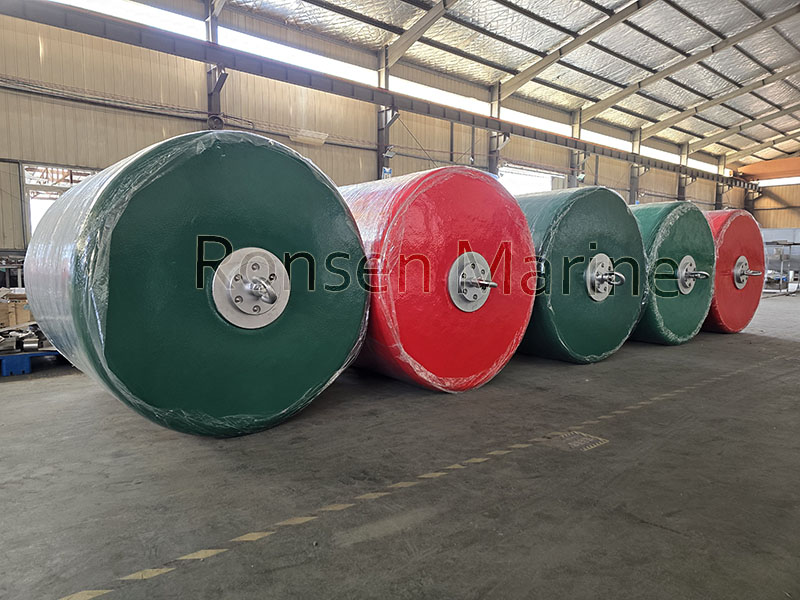
Marine surface buoys are anchored or drifting floating platforms that combine buoyancy, mooring, power, sensors and telemetry to deliver real-time ocean and atmosphere data. They sit at the intersection of maritime navigation, oceanography and offshore engineering—marking channels, riding waves and streaming sea-surface temperature, wave spectra, wind and salinity to shore stations via satellite or cellular links.
This guide covers how surface buoys are built, which variables they measure, how data reaches the cloud, and how buyers should specify a buoy for coastal, metocean or scientific deployment.
What Is a Marine Surface Buoy?
A marine surface buoy is a watertight float that keeps instruments at or near the air–sea interface. Unlike subsurface moorings or ARGO drifting profiles, a surface buoy exposes a mast above water for wind, pressure and AIS, and a central well below for CTD, ADCP or water-quality sondes.
Core subsystems:
- Hull – polyethylene, Surlyn-foam, FRP or steel; 0.3 m to 3 m+ diameter
- Mooring – chain/nylon scope, gravity or drag-embedment anchor
- Power – solar + lithium battery, 12–18 month autonomy typical
- Sensors – meteorological, wave, oceanographic
- Comms – Iridium, 4G/5G, Beidou, GSM, UHF/VHF
- Control – data logger, GPS, watchdog, anti-fouling schedule
Types of Marine Surface Buoys
[supsystic-tables id=23]
Navigation buoys follow IALA Region A/B color rules; scientific buoys follow NDBC or national metocean standards.
Key Sensors and Measured Parameters
Modern surface buoys are sensor hubs:
- Meteorological: wind speed/direction (0.1–60 m/s), air temp, humidity, barometric pressure, rainfall, solar radiation
- Wave: heave accelerometer → significant wave height (0–30 m), peak period, direction, energy spectrum
- Ocean: sea-surface temperature (±0.01 °C), conductivity/salinity, DO, turbidity, pH, chlorophyll-a
- Current: ADCP on underside well, 0–5 m/s, profile to 200 m
- Positioning: GPS/GNSS, AIS Class B for collision avoidance
Example compact unit: PE hull Φ936 mm, 68 kg, 340 Ah lithium, 32 GB storage, 60-min default sample, Iridium/4G uplink.
How Marine Surface Buoy Data Reaches Shore
- Sensor samples at 1 Hz–1 hr interval
- Logger time-stamps and buffers
- Modem compresses and transmits via Iridium SBD, 4G or Beidou
- Shore station or cloud (NDBC, Copernicus, proprietary SCADA) ingests
- API feeds forecast models, dashboards, alert thresholds
NOAA’s National Data Buoy Center runs one of the largest public networks; in 2025 it upgraded NDBC 44008 off New England with sharper wave/weather sensors.
Where Marine Surface Buoys Are Used
- Oceanography & climate – ENSO, SST trends, heat content, carbon flux
- Offshore wind – pre-install metocean campaigns, wake & fatigue input
- Port & channel safety – lateral/cardinal marks, AIS virtual aids
- Disaster early warning – tropical cyclone intensification, storm surge
- Aquaculture – dissolved oxygen, temperature, algal bloom flags
- Defense & range ops – exercise zones, submarine cable marks
A single metocean buoy can cut route-planning fuel use by feeding current/wind nowcasts to vessels.
Buying Specs: How to Choose the Right Surface Buoy
Match the platform to site, not catalog:
- Water depth – 10 m coastal vs 6000 m deep mooring changes anchor scope
- Wave climate – spar buoys for low motion, disc buoys for ride-through
- Autonomy – solar-only fails in polar winter; size lithium for 6–12 mo
- Comms latency – Iridium for remote, 4G near coast
- Standards – IALA for AtoN, IMO for offshore, CCS/ABS for hull class
- Serviceability – 2-year maintenance-free hull/anchor saves vessel days[ccitation:2]
Maintenance and Lifecycle
Surface buoys fail from biofouling, mooring fatigue and connector corrosion—not electronics. Best practice:
- 6-month visual/AIS position check
- 12-month haul-out: grease mooring shackles, swap desiccant
- Calibrate CTD against lab standards annually
- Record uptime %; NDBC-grade assets target >90% yearly
Steel/PE hulls last 10–25 yr; foam-core PE spar buoys often hit 15+ yr with anti-foul paint.
FAQ
Q: Are marine surface buoys the same as ocean data buoys?
Yes, “surface buoy” describes position; “data buoy” describes function. A metocean surface buoy is a data buoy.
Q: How deep can a surface buoy moor?
Anchored systems deploy from 10 m to 6000 m; deeper water needs subsurface float pack to reduce scope load.
Q: Do surface buoys work in hurricanes?
Survivable-class buoys (e.g., NDBC 3 m hulls) ride out category 3–4; spar designs survive by minimizing drag.
Q: What does a basic scientific surface buoy cost?
Compact coastal PE buoys start low five figures; 3 m offshore metocean systems with ADCP+CTD+Iridium run six figures including integration.
Q: Can I stream buoy data to my own dashboard?
Most 2026 vendors expose JSON/MQTT or REST from the shore station; choose a logger with open protocol, not locked binary.
Authority Links to Cite (outbound)
- NOAA National Data Buoy Center – https://www.ndbc.noaa.gov
- IALA AtoN buoyage – https://www.iala-aism.org
- AXYS / NexSens / OSIL manufacturer specs for hull tables